Location-based data analysis and mapping (GIS)
At CESsoils we make use of our in-house environmental drafting to support every of our projects with Geographic Information System (GIS) technology.
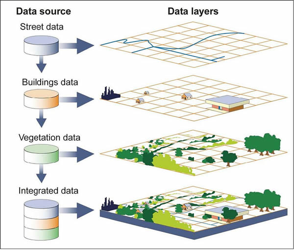
A GIS collects, manages and analyses location-based data from various sources with different attributes in one system to support landscape planning and decision making.
Here at CESsoils, we integrate cadastral and topographic data, soil information, data from other consultants such as surveyors and ecologists, digital elevation models, aerial imagery, and datasets from the Local and State Authorities on planning instruments, restrictions, land capabilities and hazards with our own field observations.
Combining these different sources of information in a GIS provides us with a holistic view of a property and enables us to make more informed decisions to support our clients with their projects.
Projects
- Queensland Hunter Gas Pipeline (click to open)